“How clean is the North Saskatchewan River?” “Is the river safe to swim in?” “How do industry, residents, and agriculture affect the river’s health?” These are all questions NSWA staff commonly encounter from curious folks across the North
Saskatchewan River (NSR) watershed, and thanks to SaskWatch, we have a better grasp on the answers. The SaskWatch monitoring program is a collaborative project between the Government of Alberta, EPCOR, the North Saskatchewan Watershed Alliance (NSWA), and the City of Edmonton.
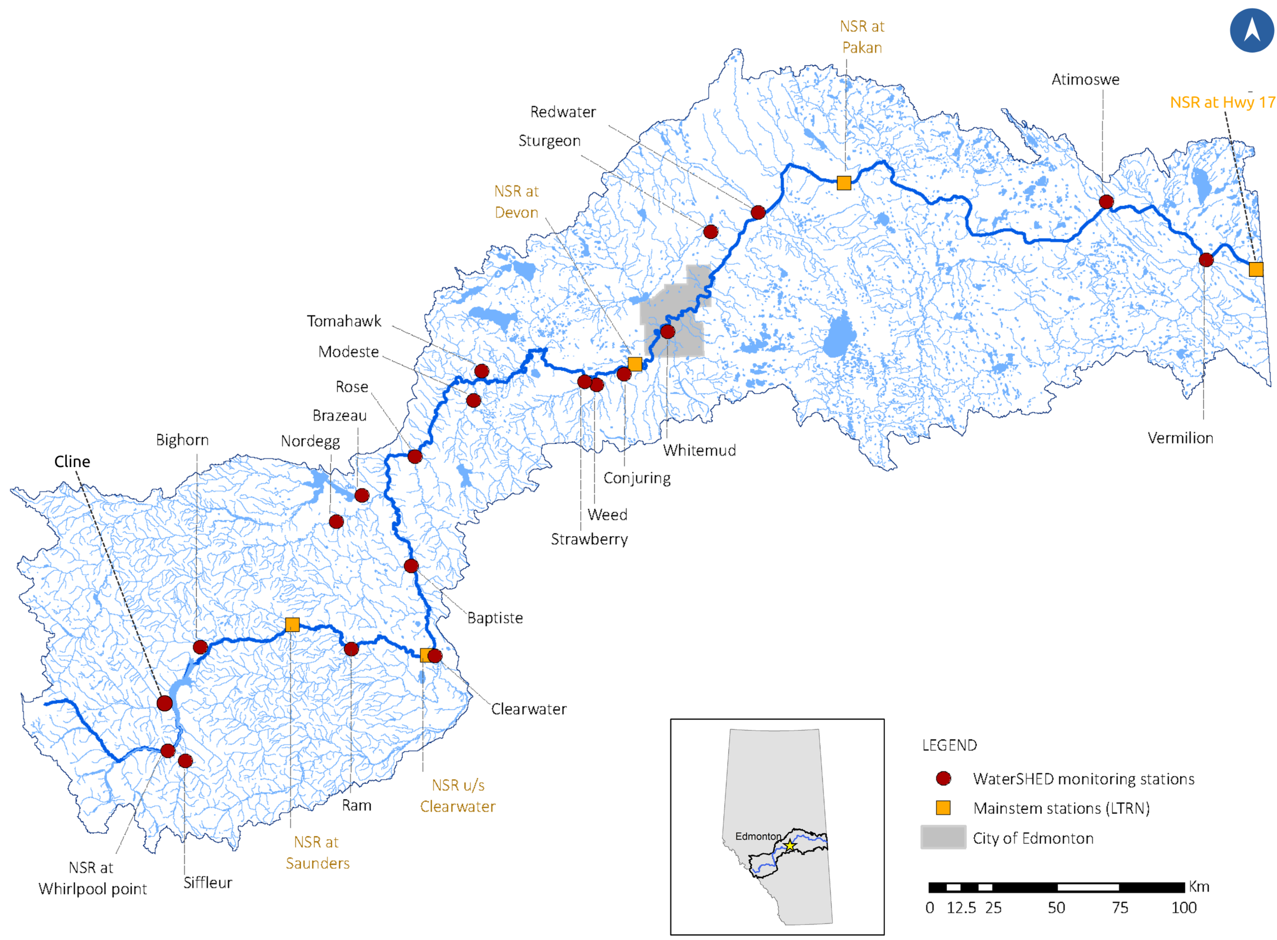
By joining forces, the SaskWatch team has developed an extensive 20-station tributary monitoring network throughout the region, allowing scientists to track water quality and quantity over time. We spoke with an aquatic scientist about the project and how it is slowly advancing our understanding of the NSR’s hydrology and water quality as we collect and compare more data. The 2018-2021 technical progress report compiles and summarizes the data we have so far, and is available to read here.
Looking to Tributaries to Tell a Story
Until 2018, water quality monitoring in the watershed was mostly limited to four long-term Government of Alberta stations on the mainstem of the NSR. WaterSHED added 20 monitoring stations on the NSR’s tributaries – these are the smaller rivers and creeks that flow into or contribute water to the mainstem. The Cline, Nordegg, Sturgeon, and Vermilion rivers, for example, are all tributaries of the NSR, and make up a vast network of water flowing across the watershed’s landscapes into its main river channel. Without understanding the hydrology and water quality of this network, it would be challenging to fully grasp long-term trends within the NSR itself. As our aquatic scientist explains, “we get a better sense of how land cover and land use are influencing water quality and that's something you don't easily get in the large main stem rivers.”
“I think most of these assumptions are that rainfall goes into the tributaries and only affects water quality changes in the mainstem. And it’s not that simple, the mainstem itself can do a lot of things that impact water quality.”
~ Aquatic scientist, SaskWatch project
The project kicked off in 2018, and WaterSHED data began trickling in. Alberta experienced heavy precipitation in 2019 and 2020, and our WaterSHED expert explains, “in those wet years, it doesn’t matter as much what’s coming in off the tributaries… I think most of these assumptions are that rainfall goes into the tributaries and only effects water quality changes in the mainstem. And it's not that simple, the mainstem itself can do a lot of things that impact water quality.” He explains that 2021 was a very dry year, providing scientists with a good understanding of how the watershed functions as weather patterns shift over subsequent years. He notes that in 2021, the tributaries were essentially “turned off,” due to low rainfall throughout the watershed, and that “basically what we’re getting all the way down through from the mountains to downstream of Edmonton was pretty much water out of Abraham Lake.” The scientist adds that the interannual weather conditions seem to have a bigger impact on water quantity and quality than differences in the surrounding landscape.
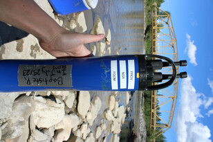
Inside the SaskWatch Stations
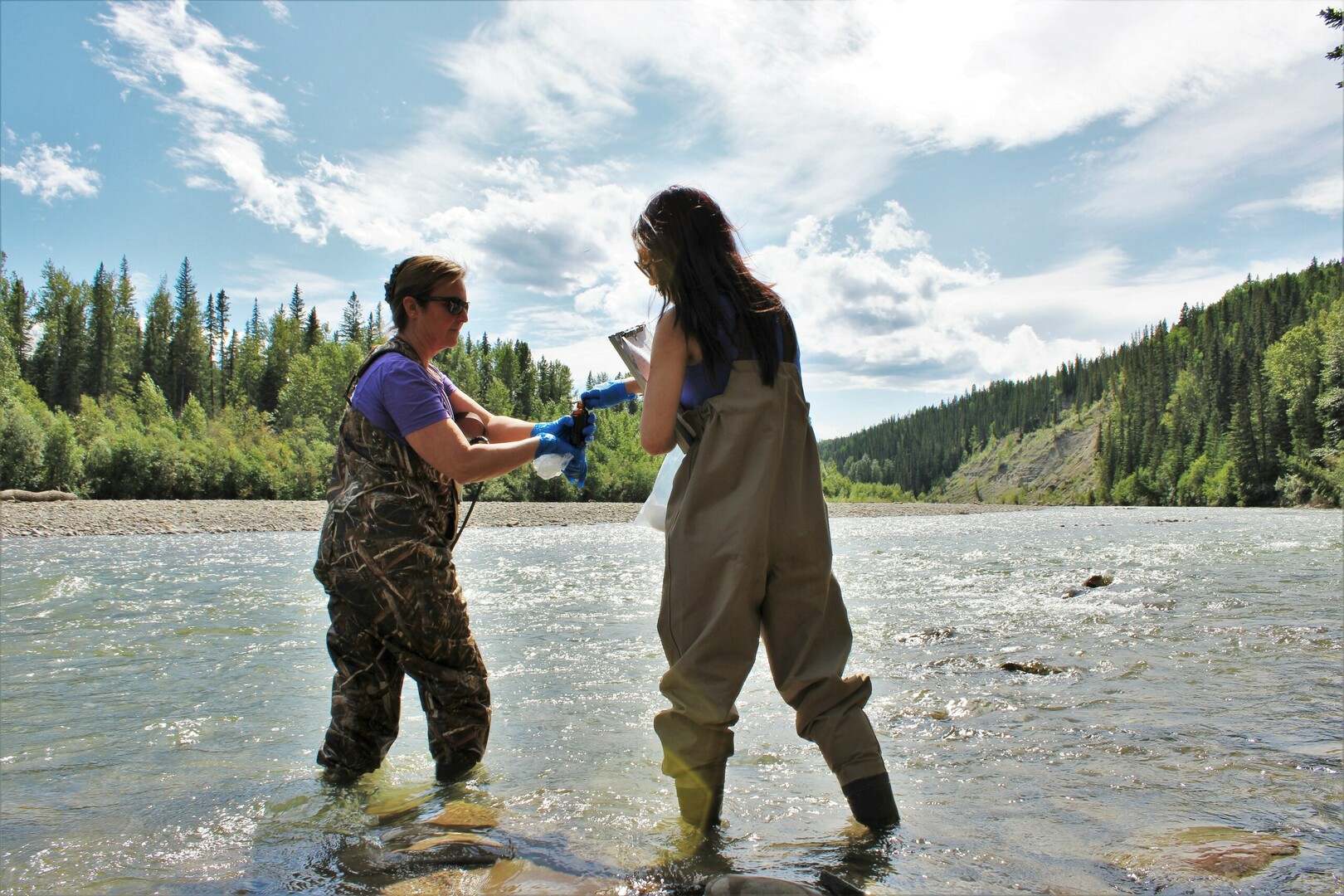
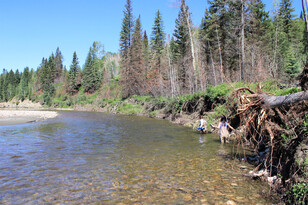
SaskWatch stations feature a suite of monitoring components, including automated equipment, in-stream multiprobe data sondes, and periodic measurements by Government of Alberta field technicians. Automated recordings at each site provide near-constant water flow and water level data, publicly accessible on Alberta Rivers. Water quality probes are left in-stream in smaller rivers for most of the open water season but can remain in the NSR’s larger tributaries throughout the winter, providing consistent data year-round.
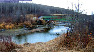
Additionally, daily photos of the rivers from monitoring stations allow technicians and scientists to compare data with real-time conditions, including correcting flow measurements, monitoring flow increases during rainfall events, and determining ice break-up dates. These images also provide a great overview of each river’s hydrological shifts throughout the seasons. Timelapse videos for Atimoswe Creek, Vermilion, and Siffleur River are great examples of this!
The Impact of an Extreme Wildfire Season
The summer of 2023 was a big fire season across Canada, and the NSR watershed was no exception. The aquatic scientist explains that WaterSHED had “two stations on tributaries where upstream burning occurred – the Nordegg and Brazeau rivers.” In fact, the Nordegg station’s camera was burned in a May wildfire, resulting in a loss of imaging for a couple of weeks. So how do wildfires like this impact water quality, what does the data tell us? He explains that the 2016 Fort McMurray wildfires expanded research in this area, with post-fire monitoring demonstrating increased sedimentation and nutrient loading downstream through river networks. The scientist explains that following wildfires, the “armouring of vegetation keeping the soil together is lost,” allowing nutrients, sediments, and ash to flush into waterways during rainfall events.
What the Data Shows – Water Quality
The parameters monitored at these stations are typical for other projects across Alberta. These include general chemistry, pH, trace metals, and nutrients, including nitrogen, phosphorous and carbon. However, our aquatic scientist explains that “because the first four years have been more of a diagnostic assessment, we can’t really assess if conditions have changed across the watershed yet. Considering the differences in conditions each year, we don’t quite have a long enough record on these sites to really know how things are changing.” Data collected during the first years of the project allows scientists to establish a baseline of what is normal for the watershed.
Although more long-term data are required to properly gauge changes over time, and determine pollution sources, changes in space are more readily apparent. WaterSHED data demonstrates, “pretty drastic changes in water quality from the mountains down through the forest and foothills areas, and then into the agricultural and urbanized plains.” As the NSR begins at the Saskatchewan Glacier and travels eastward through Alberta, it crosses some major urban zones, including the Edmonton Metropolitan region. “You can see clearly, changes in nutrients and salts and some metals. Particularly around the Drayton Valley area, when you start getting more clearing of former grasslands and forests into agriculture and residential areas.” One notable parameter was found to change remarkably in concentration downstream from the watershed’s pristine headwaters: chloride. Whitemud Creek in Edmonton had particularly high concentrations, and our expert remarks that, “it gives you an idea of the impact of road salts, not only just on the concentration of these small creeks, but that it’s the most important contributor of chloride from any of our tributaries.” He highlights this as interesting because Whitemud Creek is smaller than most of the watershed’s other monitored tributaries, and notes that, “But because it's so urbanized, it really gets that chloride input.” As for pointing to a culprit for some of these pollutants, the aquatic scientist says that, “We aren’t there yet - we can see where contaminants are coming from but more data are needed to know how much.”
What’s Next?
Looking ahead, SaskWatch will not only collect data on a host of chemical parameters, but aim to “expand biological monitoring.” Our expert explains the importance of monitoring biological health, noting that “the communities that live there may be better indicators of the health of the river because they live in one place and experience all the changes in water quality.” The Watershed Integrity Project, a joint venture between the University of Alberta, the Government of Alberta, and funded by Alberta Innovates, completed ‘whole ecosystem monitoring of tributaries across the North Saskatchewan watershed’ and analyzed benthic species and microbial communities to better understand the impacts of land-use changes on ecological health. However, the scientist notes that collecting biological data is time-consuming and labour-intensive, providing a major barrier for many monitoring programs. Environmental DNA (eDNA) monitoring provides an exciting potential solution, allowing scientists to interpret the types of species present in each water sample through efficient DNA analysis. It is only a matter of time before eDNA data becomes more readily available in our watershed, allowing SaskWatch to bolster its chemical data, and provide us with a clearer understanding of the general health of the entire network.
To learn more about the project, go to:
- An overview of the project on the NSWA's website.
- The SaskWatch monitoring program: 2018-2021 Technical Progress Report
- Watershed Wednesday Webinar: How Healthy is the River? With Craig Emmerton and Mike Christensen.
- To view monitoring stations and track river flows, download
the Alberta Rivers mobile app or visit the website.