In 2019, NSWA partnered with the Government of Alberta and the University of Alberta on the Watershed Integrity Project. As the project wraps up, we wanted to meet with the project leads and their team of researchers to better understand what they set out to find and what they uncovered.
Funding & Focus of the Watershed Integrity Project
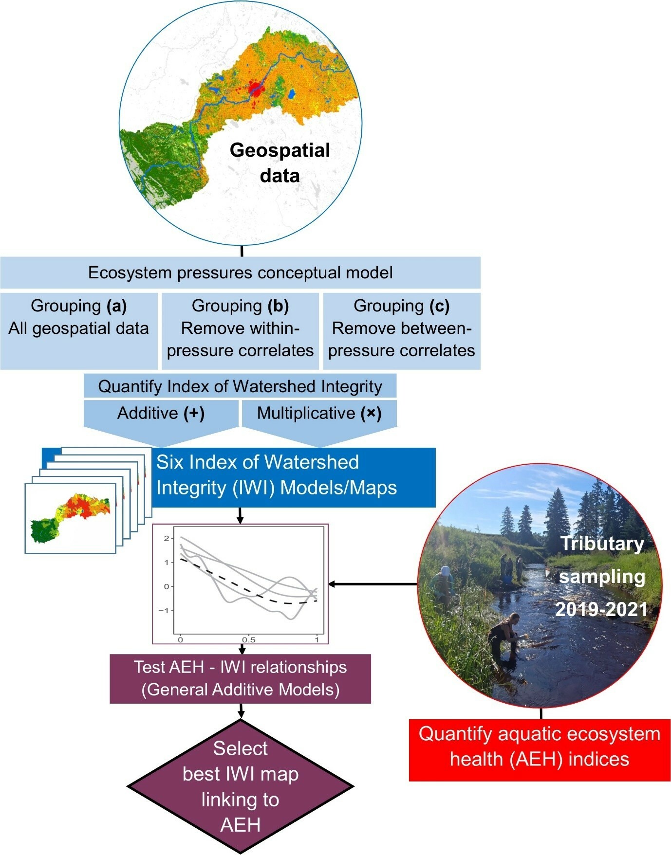
In 2018, Government of Alberta researchers Drs. Craig Emmerton (aquatic scientist), Faye Wyatt (geospatial scientist), Cristina Buendia (aquatic scientist), and Mina Nasr (geospatial scientist) joined Dr. Rolf Vinebrooke (University of Alberta professor in Biological Sciences) as Principal Investigators on the North Saskatchewan River Watershed Integrity Project (NSRWIP). The aim of this project was to link robust GIS information on landscape condition across the river basin with aquatic ecosystem health of streams draining those landscapes. In 2018, they secured a three-year, $750,000 grant from the Alberta Innovates Water Innovation Program to conduct geospatial analysis and monitor tributaries across the basin—measuring everything from water quality to microbes, algae, invertebrates, and fish.
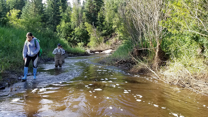
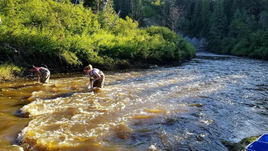
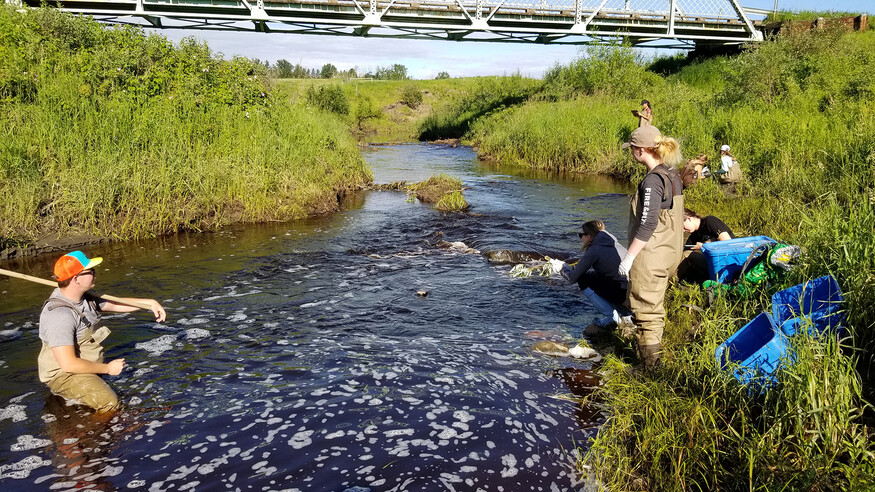
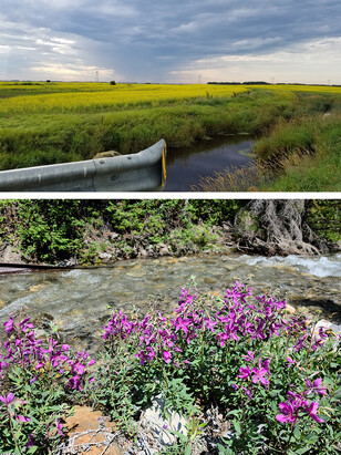
By focusing on smaller streams and creeks rather than the NSR mainstem, NSRWIP aimed to better understand how landscapes influence stream conditions, especially in under-studied areas. Combining publicly available GIS data with intensive fieldwork at 80 sites allowed for a deeper, more accurate picture of watershed health and landscape connections.
Partnering with the University of Alberta
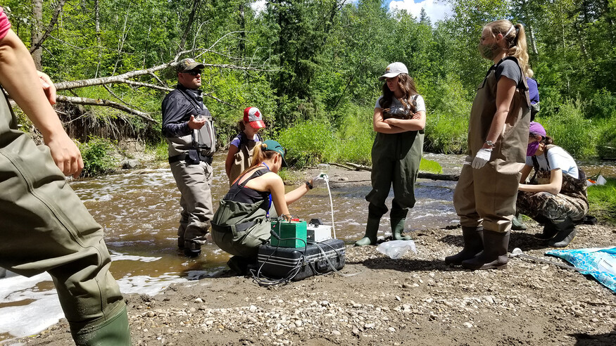
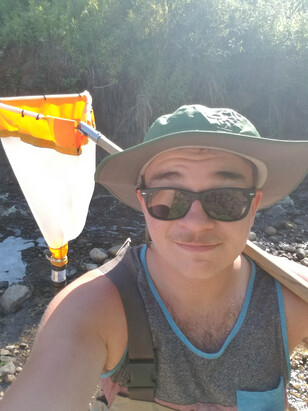
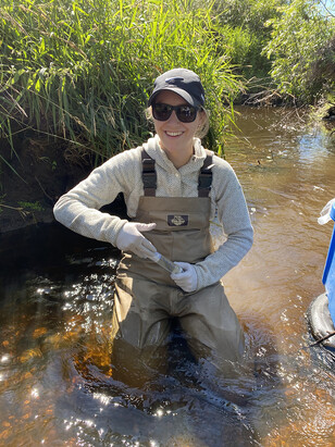
Several University of Alberta professors and their Master’s and PhD students collaborated with the NSRWIP team to carry out the fieldwork. Dr. Vinebrooke led the periphyton and algae portion of research, Drs. Mark Poesch and Stephanie Green led the fish research, and the late Dr. Maya Bhatia led the research on water quality and microbes. Emmerton adds that “a small army of undergraduate summer field technicians” also did a fantastic job helping collect the data each summer.
Vinebrooke calls the NSRWIP “a good multi-proxy approach to bioindicators,” providing valuable baseline data rarely seen in other studies. He notes that before the project, most site data was chemical or physical, with little understanding of stream biology. Emmerton adds that while water chemistry reflects some landscape and groundwater conditions, understanding true ecosystem health depends on biological responses to many factors.”
Student Researchers: Opportunities & Findings
Shelby Stenerson
Dr. Shelby Stenerson discovered her passion for algae in one of Vinebrooke’s classes and joined his lab to study lake cyanobacterial blooms. Once the NSRWIP began, Stenerson happily shifted her focus to river and creeks of this project.
Stenerson calls periphyton (attached algae) “first responders” because, like microbes, they are at the bottom of the aquatic food web. Although algae aren’t as charismatic as some other aquatic organisms in the study, "they have a really short generation time [and] they grow and respond quickly to changes in water quality, whether it be trace metals, nutrients, pollutants. The periphyton are very sensitive - or they can in some cases be extremely tolerant – so their presence or absence can indicate certain changes.”
Initially, Stenerson hoped to find a direct link between broad land use patterns and algal community composition. The analysis showed no statistically significant results for regional factors, which she says “was disappointing.” However, she says they were able to use local variables (collected by Jill Lightbown) such as water chemistry and physical variables. With help from Dr. Anas Mohamed Usoof, they used Structural Equation Modeling to find many indirect links between regional factors and algal communities through local variables.
Blake Stuparyk
Dr. Blake Stuparyk, who had previously worked with Rolf Vinebrooke on a lake project, joined the NSRWIP after being promised “novelty and experience.” He says the chance to study tributaries and understudied aspects of the NSR delivered exactly that “in spades.”
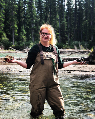
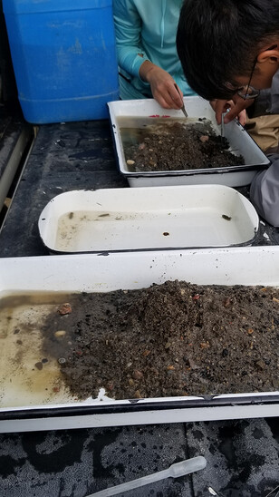
Stuparyk sampled macroinvertebrates (bugs in the river mud) and adapted the CABIN protocols (created in Ontario and tested in BC for macroinvertebrate sampling) to better suit the rivers and creeks he sampled in. “I learned how to sort through samples roadside on the back of the tailgate,” he explains, due to the amount of detritus like dirt, sticks and leaf litter captured when sampling.
Stuparyk’s research examined both taxonomic differences and the traits of the bugs, revealing that even visually distinct organisms can play similar roles in an ecosystem. By comparing communities in taxonomic and functional space, he assessed ecosystem stability based on group presence and abundance. “It's adaptability and resilience that are the bigger story there.”
Asked about parallels between his findings and any of the other research within the project, he says there was definitely a similarity between his findings and the findings for fish. “How the buffet looks is going to dictate what the crowd looks like.”
As a born and raised Edmontonian, Stuparyk said the collaborative and regional aspect of the project was interesting because “the NSR is my home. Being able to study it in multiple directions at the same time was really cool.”
Both Stuparyk and Stenerson stayed with the project through their PhDs and their manuscripts should be submitted to a peer-reviewed journal sometime in the next year.
Jill Lightbown
Jillian Lightbown was volunteering in Dr. Bhatia’s lab as an undergrad student when Bhatia asked if Lightbown would be interested in collecting samples for the WIP. Lightbown loved the microbial work with Bhatia and transitioned into her Master’s work for the next couple of summers.
Lightbown says stream aquatic microbial research is still in early “exploratory” stages, unlike the more established work on other organisms. She found distinct microbial communities across ecoregions, except between urban and agricultural sites. This may be due to more homogenized landscapes in the eastern basin. The intact Rocky Mountains showed by far the most diverse community of microbes compared to anywhere else in the basin and was not what they expected to see in these nutrient poor environments.
Anas Mohamed Usoof
Dr. Anas Mohamed Usoof joined the project in 2021 as a post-doc to develop a model to associate all geospatial data on landscape condition with the over 100 field-based parameters collected from streams across the NSR. This was no small task due to the breadth and complexity of the collected data. Anas’s statistical work enabled the project to produce a map of the NSR basin that reflects both landscape and aquatic ecosystem health conditions to help guide stewardship and rehabilitation work across the basin. This work also showed that water quality, macroinvertebrates, and fish were the best aquatic ecosystem health indicators linking to landscape condition. In addition, Anas also guided Shelby with her Structural Equation Modelling work. Anas is now an assistant professor at the University of Winnipeg in the Department of Biology.
Partnering with the NSWA
NSWA is a key partner on the NSRWIP. Emmerton says, “We love working with the NSWA just because [they] have a better connection to the communities and the users of these streams than the university or provincial government could.”
An ArcGIS StoryMap of this project will allow people to see the context and view photos, text, and maps that weave together the science with some of the unique stories uncovered through this work. This piece will be published in conjunction with the NSWA’s upcoming State of the Watershed online report.
A public-facing dashboard will share the project’s data and findings in a more accessible, visual format. Emmerton hopes it helps stewards and municipal leaders identify priority areas for restoration and conservation without needing additional baseline studies.
Challenges: Climate & Ecology
Emmerton says that coordination of the project was challenging due to remote sites, safety risks in the foothills and Rockies, and COVID-related delays and costs. He and Cristina were able to coordinate travel remotely while the University of Alberta field team handled sampling safely and efficiently.
Sampling began during wet summers in 2019–2020, but the 2021 heat dome drastically changed conditions. Emmerton says streams went from high flow to drying up or becoming stagnant in less than a year. While some sites were not suitable to sample in 2021 and had to be replaced, these juxtaposing weather conditions strengthened the project and its applicability between years.
Vinebrooke noted that unlike microbes, algae, and invertebrates, fish face dispersal barriers like dry channels or beaver dams. He emphasized that when using bioindicators, it’s important to consider such limits on how well certain groups can reflect environmental conditions.
Key Takeaways & Strengths of the Project
Emmerton says a key takeaway of this project is that their land condition map reliably reflects stream conditions. By linking geospatial data to stream impacts, they could map the entire NSR basin by impact level—making stream conditions more predictable based on landscape features.
Another key goal was to identify which river indicators best reflect landscape conditions. As expected, water quality was a strong indicator. Emmerton notes that benthic invertebrates and fish also showed clear links, while smaller, less mobile organisms like microbes and periphyton were less directly connected.
Emmerton says a key strength of the project was monitoring diverse landscapes and stream types simultaneously—unlike many studies that focus on a single region. “Within the study region, we've got mountains, foothills, agricultural areas, and urban areas and were able to package this all nicely together to give that broader overview of the whole watershed.”
Looking ahead: Climate & e-DNA
Emmerton says eDNA could be a more efficient, cost-effective way to monitor changes in stream ecosystems. With a species library—from microbes to fish—future assessments could rely on eDNA instead of repeating the labour-intensive and expensive fieldwork. This approach could still detect key shifts, like the return of pollution-sensitive species to formerly impacted streams, without needing major funding.
Vinebrooke says a major unknown is how stream tributaries will respond to increasing climate extremes, like floods and droughts, which could significantly disrupt these systems in the future.
Emmerton sees this work as a tool for stewards, though they’re still figuring out exactly how they might look. He says the NSRWIP team is open to discussing with NSWA how it can support community involvement and restoration efforts. He adds that their results could also be focused on specific streams to identify the most impacted areas and determine where to best target stewardship.
Hopeful about the Future Scientific Generation
Emmerton finished by saying how impressed he was with the young scientists he worked with. “You always hear [the challenges working with] younger generations today. The young students I dealt with at the graduate level were phenomenal. They are way smarter, way more connected, way more informed than I ever was at that same stage in my career. They also have fantastic drive and were able to get the work with very little drama. So, hats off to them.”