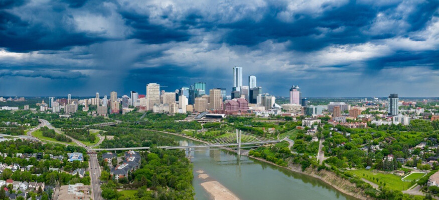
The City of Edmonton is currently in the end stages of revising its River Valley Area Redevelopment Plan (River Valley ARP) and Ribbon of Green Strategic Plan. These plans were originally created in the 1980s and 90s and are now being updated to reflect present-day community values, planning principles, and understanding of ecosystem function. We sat down with Angela Hobson to learn more about these initiatives and how they relate to watershed health.
Early Interest in Green Spaces
As an Ecological Planner with the City of Edmonton, Angela Hobson comes by her passions honestly. Growing up in Kelowna during a growth surge, Hobson learned from her father’s work as a parks and heritage planner. She recalls conversations around the kitchen table about the “importance of setting aside park space - for people and for wildlife - in a community that was growing really rapidly”.

Completing an Environmental Studies BA from the University of Ottawa gave Hobson a multi-dimensional view of the environment and drew her to further studies. “I saw the opportunity to apply systems thinking to open space planning in an urban context”. Completing her Masters in Community and Regional Planning at UBC allowed her to pursue her interest “in the intersection between ecology and community” – with both its opportunities and challenges. In 2005, she accepted a position as an Ecological Planner with the City of Edmonton, where she has worked on a number of city-wide open space and ecological strategies, including Natural Connections Strategic Plan, Breathe, and mostly recently, the Ribbon of Green.
BREATHE – Edmonton’s Green Network Strategy
Breathe (Edmonton’s Green Network Strategy) is the ‘open space’ strategy for the whole city of Edmonton. Hobson says the strategy includes “a pretty broad definition of open space – from natural spaces to urban plazas to neighbourhood parks to district parks.” It essentially includes all publicly accessible open space.
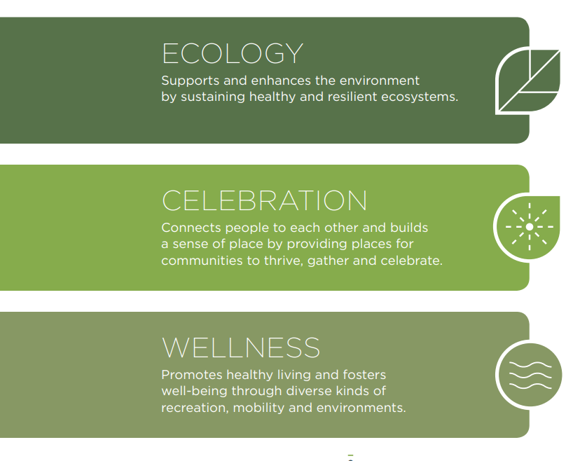
Breathe looks at open space through three lenses:
1. Ecology
2. Celebration
3. Wellness
“Breathe looks at opportunities to increase those different functions within an open space, knowing that we have limited land within the city,” shares Hobson. An example would be creating habitat by planting some trees or shrubs around the outside of a sportsfield, so different functions are being layered.
Breathe includes parks and green spaces across the city and Hobson calls the North Saskatchewan River valley and ravine system the backbone of this open space network. The City wants to ensure that there are enough park spaces across the city so ”communities can access them to meet their open space needs.” Hobson cites the different needs of a neighbourhood near downtown versus a suburban neighbourhood. She explains that while someone living in suburban area may have more green space right in their backyard, someone living in an apartment building downtown would not, so their open space needs are distinct. Breathe considers these nuances of what access to these open spaces looks like.
Ribbon of Green: A Strategic Plan for the Edmonton River Valley
The Ribbon of Green (ROG) takes the policies and multifunctional approach used in Breathe and translates them for a river valley context. Hobson notes that there is more of an emphasis on ecological protection in the river valley, given its function as an ecological and wildlife movement corridor through the region. At the same time, it’s important to give people access to the river valley and the unique experiences it provides.
Hobson says that Edmonton is lucky that so much of its river valley is protected. “While a lot of cities have rivers that go through them, our situation in Edmonton is pretty unique because of how steep and deep the North Saskatchewan river valley is. That makes certain kinds of development just not possible in much of the system.”
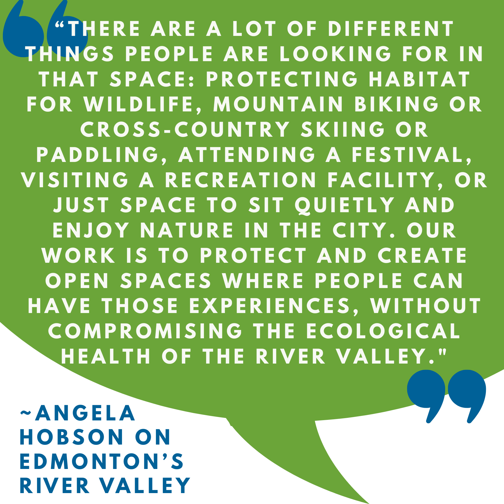
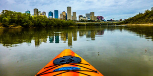
The Ribbon of Green policies align with the strategic directions in Breathe: ecological protection and restoration; providing good access to open space; and creating safe, well-designed park spaces for many different people and experiences. Hobson says that the river valley presents particular challenges and opportunities in open space planning: “People love the river valley, and it’s such an important part of Edmonton. There are a lot of different things people are looking for in that space: protecting habitat for wildlife, mountain biking or cross-country skiing or paddling, attending a festival, visiting a recreation facility, or just space to sit quietly and enjoy nature in the city. Our work is to protect and create open spaces where people can have those experiences, without compromising the ecological health of the river valley."
North Saskatchewan River Valley Area Redevelopment Plan
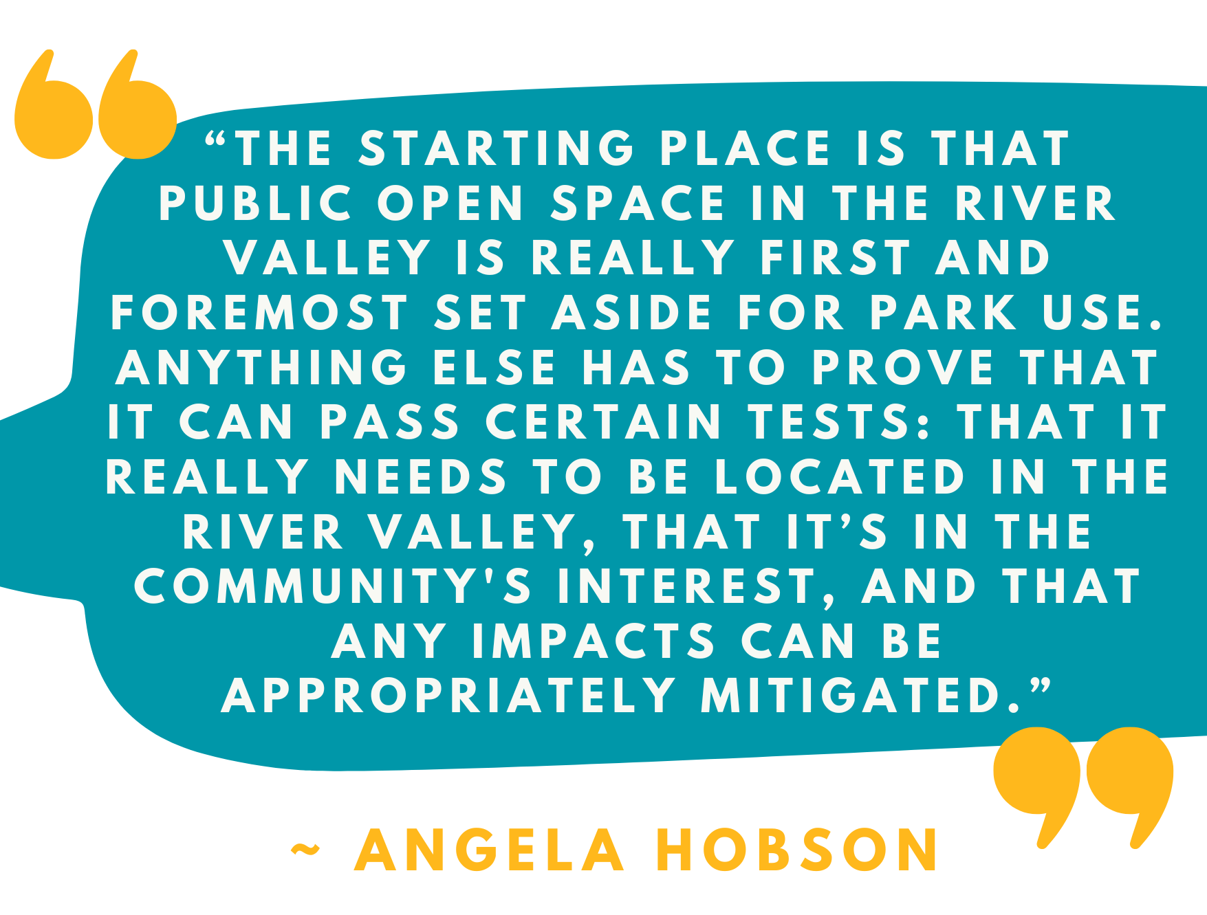
The North Saskatchewan River Valley Area Redevelopment Plan (River Valley ARP) provides the regulatory tools and decision-making framework to guide decisions about proposed development in the River Valley. The revised version sets clearer limits on intensive or high impact uses, updates assessment requirements for proposed development, and provides direction for public and Indigenous engagement. Hobson says about the ARP, “The starting place is that public open space in the River Valley is really first and foremost set aside for park use. Anything else has to prove that it can pass certain tests: that it really needs to be located in the river valley, that it’s in the community's interest, and that any impacts can be appropriately mitigated.”
Hobson notes that the River Valley ARP and the ROG are being updated concurrently and will be presented together to City Council in June (and will be shared with the public beforehand in May). “The reason that we renewed these two plans together is to take better advantage of integrating those different planning streams – the strategic and the regulatory.” The ROG sets the high-level goals and strategy, while “the ARP provides the rules that guide our decisions”.
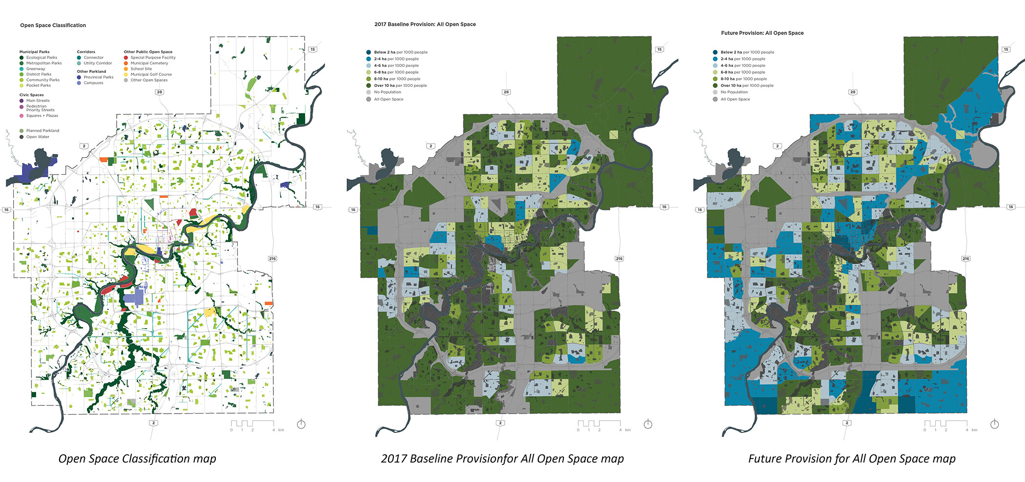
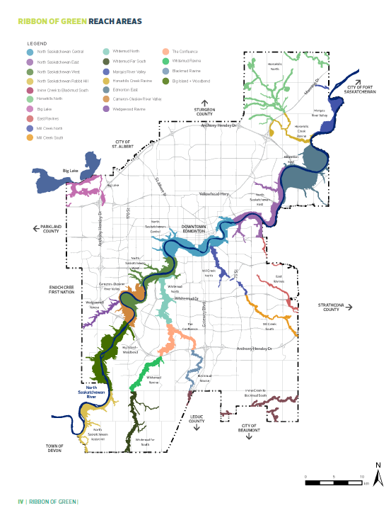
Mapping the River Valley’s future
The public can access interactive online maps for the ROG that help depict the proposed future direction and plans for the River Valley. Hobson explains that it wasn’t within the scope of the current project to do field work and on-the-ground assessment, and the maps are “based on existing data and desktop analysis.” Going forward, “more site-specific assessment will be needed. We'll want to go out in the field and do the geotechnical reviews and the ecological assessment.” This ground-level work, along with further public and Indigenous engagement, will help to confirm or refine the Ribbon of Green planning direction as the focus shifts from the whole system to specific sites in the river valley.
Viewing the Maps: What you can find
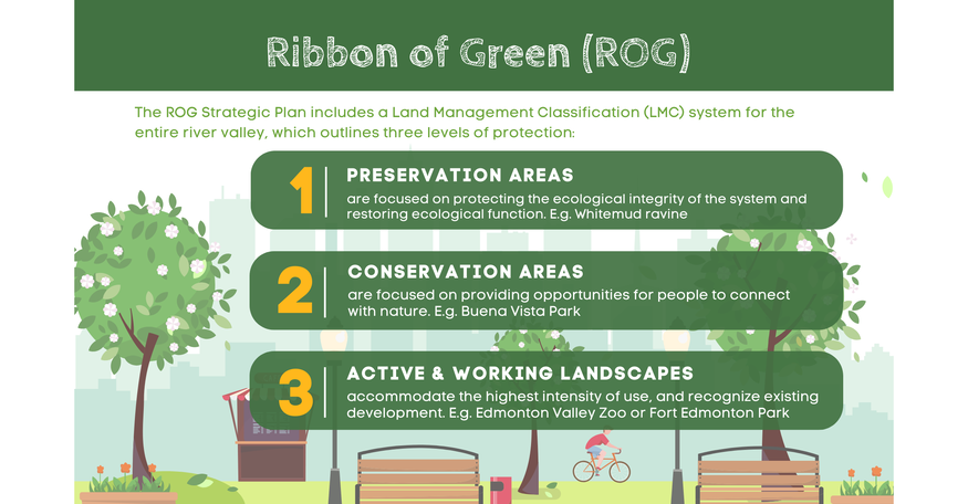
1. Land Management Classifications (LMCs) - View the three Land Management Classifications – Preservation, Conservation, Working Landscapes. Learn more about specific direction for each classification, as well as the uses and infrastructure that would be considered appropriate within each.
2. Site-specific Planning Direction for each of the River Valley’s 21 reaches, including
a. Ecological guidance
• Ecologically significant areas
• Habitat connectivity and wildlife pinch points for movement through the City
• Where to focus City restoration efforts
b. Program guidance: existing and proposed amenities, facilities, access points and trails.
3. Current Land Use for the ARP - this map shows public open space, public utilities, and commercial, residential and industrial areas
Connecting the ARP and ROG to watershed health
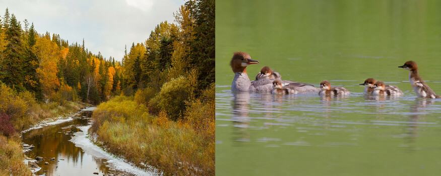
Most riparian zones in Edmonton’s River Valley have a Preservation designation, with some exceptions for existing development. Hobson says these zones right near the river and the creeks are a priority for the City and lists reasons such as wildlife movement, flood resilience, and protecting water quality.
There’s also a desire to protect fish habitat where it exists, including areas such as Whitemud Creek and in parts of the river in northeast Edmonton. Directing people to access the river at established entry points, such as boat launches and docks, helps to limit the human footprint in sensitive riparian areas. Restoring riparian ecosystems is another important aspect of this work.
The City hopes to avoid development as much as possible within the floodway, and to ensure that any amenities or infrastructure in the flood fringe can withstand periodic flooding. The Ribbon of Green provides guidance for trail planning and design in these sensitive areas, including maintaining a vegetated buffer between the trail and the river or creek, implementing a higher design standard and using more resilient materials.
Looking to the Future
The City of Edmonton is also looking at opportunities to “daylight” (restore the function of) creeks and streams in the river valley that have been diverted underground; Daylighting of Groat Ravine, Mill Creek Ravine, and Rat Creek in Kinnaird Ravine are all part of what the City terms ‘transformative projects’. These projects may be further down the road but would not only bring the creeks and streams back to the surface but also reestablish riparian habitat. “Daylighting can be costly, but the benefits - for people and for ecosystems - are significant. We’re really trying to keep those projects part of the conversation for Council and staff, so that hopefully they can be funded at some point,” says Hobson.
Low impact development opportunities - like installing rain gardens next to parking lots in the river valley, so runoff can be captured and filtered close to the source - are also in the City’s line of sight for watershed health. Knowing that water courses know no artificial boundaries, the City also hopes to partner “with adjacent municipalities on open space and ecological planning with joint efforts to protect riparian health and water quality.”
LEARN MORE:
Learn more about the Breathe Green Network Strategy
Read about the Ribbon of Green: Strategic Plan for the Edmonton River Valley
Learn more about the North Saskatchewan River Valley Area Redevelopment Plan
To be notified about next steps in the River Valley Planning Modernization project, sign up on the City's project website (scroll to the bottom of the page for the sign-up link, "Stay Informed")
Explore the interactive maps that highlight the Ribbon of Green and proposed future direction for the river valley.
Discover the City's bike trails or see the combined map for biking, walking, or scootering.