Phase 1 of tHe Riparian Health Action Plan
Beginning in 2016, NSWA developed a pilot project to assess the condition of riparian areas on major creeks and lakes in the Modeste sub-watershed. A new evaluation tool was required to evaluate riparian conditions at a watershed-scale. The NSWA commissioned Fiera Biological Consulting Ltd. to develop the new method, which uses satellite imagery to classify riparian intactness.
Riparian intactness was defined as the extent to which natural riparian habitat or shorelines have been altered by human activity. Highly intact shorelines are dominated by natural vegetation, while shorelines classified as very-low intactness are dominated by human-built structures or disturbed vegetation.
From this pilot project, three datasets were generated:
- The intactness of riparian areas
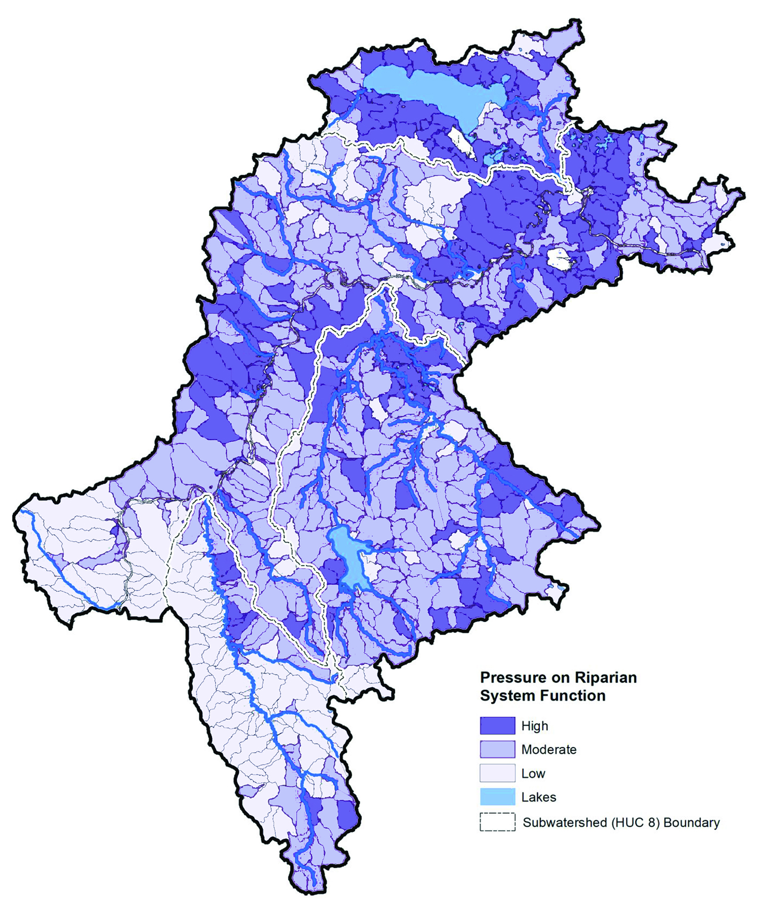
- Watershed pressures next-to to the riparian area
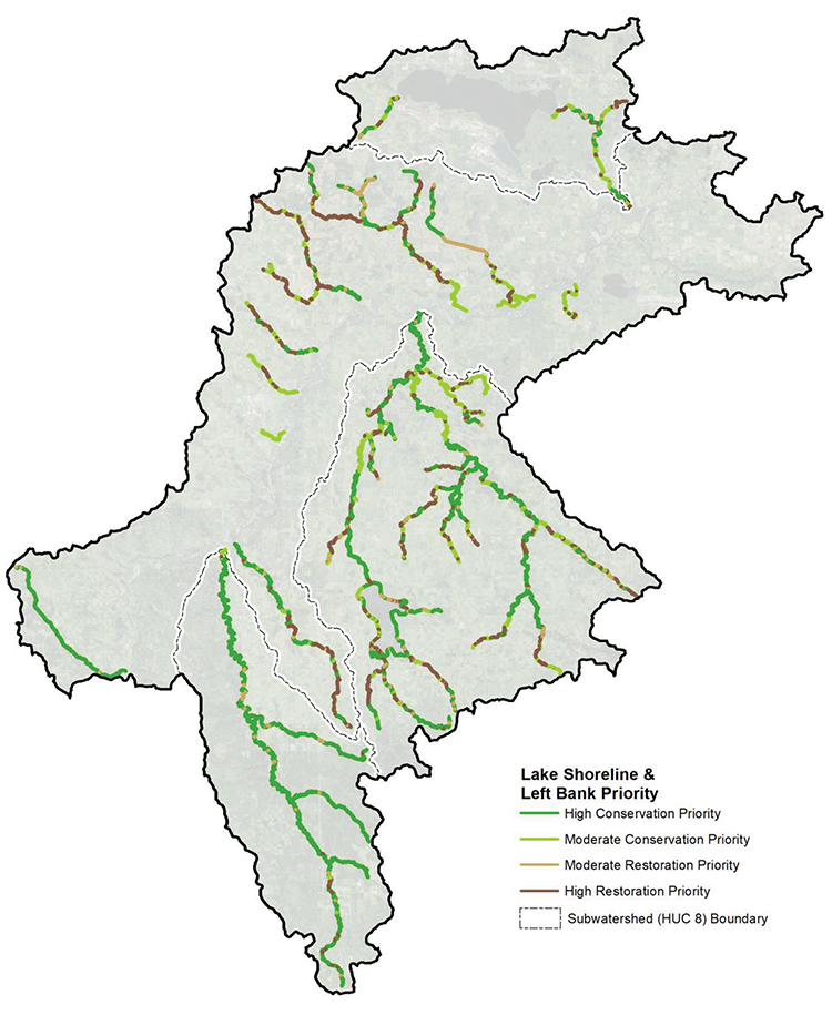
- Opportunities for restoration and conservation activity
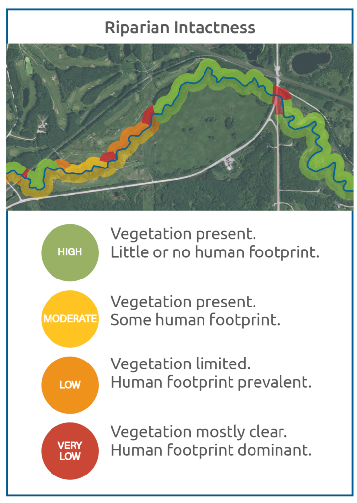
An Example of Riparian Intactness in the Modeste Subwatershed

The pilot project in the Modeste subwatershed proved to be a success! NSWA expanded it to other sub-watersheds, beginning with the nearby Strawberry and Sturgeon subwatershed and then to the Beaverhills, White Earth, Vermilion, Frog and Monnery sub-watersheds which we completed in 2021. After completing these projects, over 17,300 km of shoreline are now assessed in the NSR.
The results show that approximately 46% of riparian areas are rated as High Intactness.
NSWA is happy to report that other Watershed Planning and Advisory Councils and Non-Governmental Organizations have adopted similar projects. There are now riparian intactness projects in the watersheds of Battle River, Athabasca River, Beaver River, Red Deer River, Lesser Slave Lake and South Saskatchewan River! As of December 2021, it is estimated that over 40,000 kilometres of shoreline have been assessed using this new method.
RESOURCES FOR PHASE 1
-
Riparian Assessment Reports for the Pilot Projects: Modeste (2018); Sturgeon (2018); Strawberry (2018)
-
Riparian Area Assessment Report for the North Saskatchewan River Watershed (2021): Download Report
-
Appendix A- Summaries by sub-watershed: Download Report
-
Summaries by Rural Community: Link to Report List
-
Summaries for other Communities: Link to Report List
-
-
Assessment Methods Validation Report by the Government of Alberta (2019): Download Report
-
Download the Land Cover (2021) Dataset: Government of Alberta Open Data Source
-
Download the Riparian Intactness (2021) Dataset: Government of Alberta Open Data Source
-
Live Presentation of the Riparian Report by Dr. Shari Clare and Mary Ellen Shain (2021): NSWA Speaker Series April 28, 2021
Funding Acknowledgements:
Funding for the NSWA’s projects was provided through the Alberta Government’s Watershed Resiliency and Restoration Program, as well as the Canadian Agricultural Partnership.