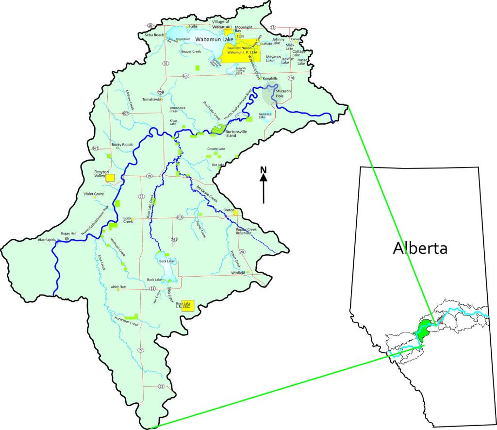
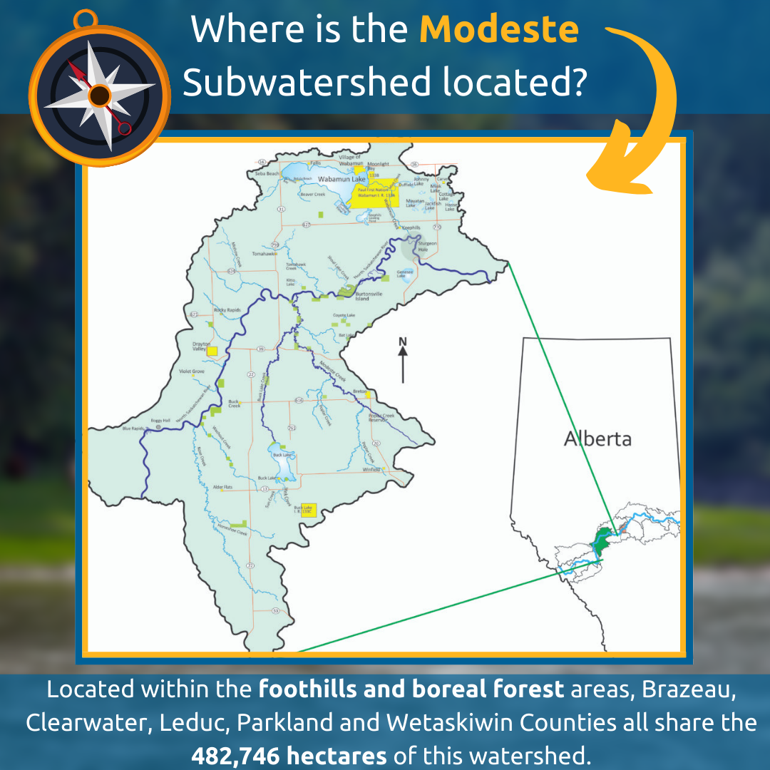
Modeste
Located within the foothills and boreal forest areas, Brazeau, Clearwater, Leduc, Parkland and Wetaskiwin Counties all share the 482,746 hectares of this watershed, as do the small communities of Alder Flats, Betula Beach, Breton, Buck Creek, Carvel, Drayton Valley, Duffield, Fallis, Kapasiwin, Keephills, Lakeview, Lodgepole, Point Alison, Rocky Rapids, Seba Beach, Tomahawk, Wabamun, Winfield, and Paul First Nation.
Oil and gas, power plants, open-pit coal mines, urban, farming, and recreational activity within the watershed affect water quality and quantity in the region. Existing assessments suggest that watershed function has been affected by human activity.
For More Information
For more details about the Modeste subwatershed check out THAT CHAPTER in the North Saskatchewan River State of the Watershed Report.
The Modeste subwatershed is one of six subwatersheds in THE HEADWATERS ALLIANCE, a team of rural and urban municipalities working to improve the health of the upper North Saskatchewan River watershed.
————————————————————————
Partnerships with lake watershed stewardship groups in the Modeste subwatershed have resulted in a series of State of the Watershed Reports and Watershed Management Plans
All available environmental information for Mayatan Lake and surrounding watershed has been gathered into a Mayatan Lake State of the Watershed Report. This report offers landowners, stakeholders, Parkland County and the Mayatan Lake Management Association (MLMA) information to be used to support sound management decisions and develop solutions to protect or enhance land and water resources in the watershed.
Mayatan Lake State of the Watershed Report
—————————————-
Using the Mayatan Lake State of the Watershed Report a Mayatan Lake Watershed Management Plan has been developed. This plan offers advice to Parkland County, the Government of Alberta, the Mayatan Lake Management Association and all watershed stakeholders to guide future decision‐making. It identifies specific actions that could be implemented, describes the roles and responsibilities of the various players to do so, and presents an implementation strategy based on both voluntary and statutory activities.
Mayatan Lake Watershed Management Plan
—————————————-
All available environmental information for Jackfish Lake and surrounding watershed has been gathered into a Jackfish Lake State of the Watershed Report. This report offers landowners, stakeholders, Parkland County and the Jackfish Lake Management Association (JLMA) information to be used to support sound management decisions and develop solutions to protect or enhance land and water resources in the watershed.
Jackfish Lake State of the Watershed Report
—————————————-
In order to generate information regarding broad trends in riparian health, a riparian health assessment for Wabamun Lake was completed in 2015. This assessment was prepared to contribute to general knowledge for the Wabamun Watershed Management Council, as well as background information to support the multi-jurisdictional planning process led by Parkland County to develop the Wabamun Lake Subwatershed Land Use Plan. Using new aerial videography methods, information regarding broad trends in riparian health was captured by a quad-copter unmanned air vehicle (UAV- commonly known as a drone). The results of this riparian health assessment indicate that approximately 57% of Wabamun Lake’s Riparian Management Area is in healthy condition, 9% of the area considered moderately impaired and 34% of the area rated as highly impaired. As well, a Watershed Management Plan for Wabamun Lake was completed in 2021.
Riparian Health Assessment OF Wabamun Lake
Wabamun Lake Watershed Management Plan
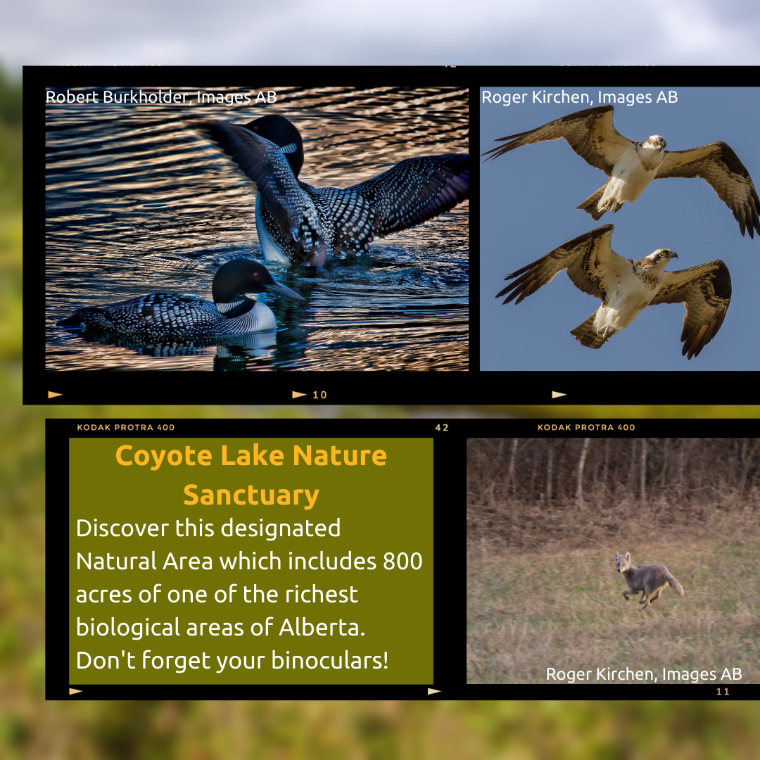
Modeste Subwatershed Photos


 - Modeste subwatershed. Western Canadian Wagon Train. Photo: Carol Rusinek")


 Two Ospreys (Pandion haliaetus) checking out the visitor. Modeste subwatershed. photo: Roger Kirchen")


